 LADY DIMINE
Current Status
Where is the vessel?
LADY DIMINE is currently in 196 nm NE of Beija-Flor, based on AIS data received about 15h ago.
Latest AIS update:
Current position: 0.53569° N, 41.41107° W (196 nm NE of Beija-Flor)
Average speed (last 7 days): Loading…
Average speed (last 30 days): Loading…
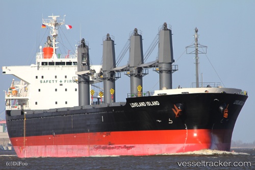
Vessel profile: LADY DIMINE is a Bulk Carrier with dimensions 169m x 27m.
This page combines live AIS, route history, probable destination signals, nearby traffic, and port activity for practical vessel monitoring.
The current position of vessel LADY DIMINE is 0.53569 lat / -41.41107 lng. Updated: 2026-05-20 09:22:24 UTCNearest reference points:
- 81 nm N of Acarau
- 141 nm N of Itarema
- 223 nm SW of Juazeiro-Pi
Currently sailing under the flag of Bahamas ![]()
LADY DIMINE built in 2010 year
Deadweight:
28316 tDetails:
Live Vessel LADY DIMINE Analytics (details, animations, etc.)
Recent AIS points (UTC):
2026-05-20 05:57:32 UTC · 0.88398, -41.94477 · SOG 11.1 kn · COG 121°2026-05-20 07:02:26 UTC · 0.76989, -41.77570 · SOG 11.3 kn · COG 118°
2026-05-20 07:56:35 UTC · 0.68462, -41.63172 · SOG 10.8 kn · COG 120°
2026-05-20 09:22:24 UTC · 0.53569, -41.41107 · SOG 11 kn · COG 126°