 SKYFALL
Current Status
Where is the vessel?
SKYFALL is currently in 183 nm SE of Bahia San Blas, based on AIS data received about 14h ago.
Latest AIS update:
Current position: 41.78012° S, 58.55080° W (183 nm SE of Bahia San Blas)
Average speed (last 7 days): Loading…
Average speed (last 30 days): Loading…
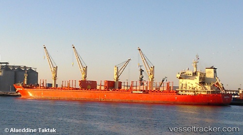
Vessel profile: SKYFALL is a Bulk Carrier with dimensions m x m.
This page combines live AIS, route history, probable destination signals, nearby traffic, and port activity for practical vessel monitoring.
The current position of vessel SKYFALL is -41.78012 lat / -58.55080 lng. Updated: 2026-06-06 09:59:48 UTCNearest reference points:
- 186 nm S of Quequen
Currently sailing under the flag of Marshall Islands ![]()
Details:
Live Vessel SKYFALL Analytics (details, animations, etc.)
Recent AIS points (UTC):
2026-06-06 05:56:51 UTC · -42.45316, -59.09052 · SOG 10.9 kn · COG 30°2026-06-06 07:10:48 UTC · -42.25333, -58.92667 · SOG 11 kn · COG -1°
2026-06-06 08:08:43 UTC · -42.09499, -58.79728 · SOG 11.5 kn · COG 31°
2026-06-06 09:59:48 UTC · -41.78012, -58.55080 · SOG 11.6 kn · COG 31°