 Njord R
Current Status
Where is the vessel?
Njord R is currently in Near Trajouce, based on AIS data received about 14h ago.
Latest AIS update:
Current position: 38.63101° N, 9.29341° W (Near Trajouce)
Average speed (last 7 days): Loading…
Average speed (last 30 days): Loading…
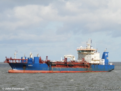
Vessel profile: Njord R is a Hopper Dredger with dimensions 111m x 20m.
This page combines live AIS, route history, probable destination signals, nearby traffic, and port activity for practical vessel monitoring.
The current position of vessel Njord R is 38.63101 lat / -9.29341 lng. Updated: 2026-05-20 10:33:37 UTCNearest reference points:
- Near Memória
- Near CASCAIS
- Near COVA DA PIEDADE
Currently sailing under the flag of Denmark ![]()
Njord R built in 2011 year
Deadweight:
6185 tDetails:
Live Vessel Njord R Analytics (details, animations, etc.)
Recent AIS points (UTC):
2026-05-20 07:24:16 UTC · 38.64987, -9.25841 · SOG 0.2 kn · COG 49°2026-05-20 07:29:56 UTC · 38.64983, -9.25848 · SOG 0.1 kn · COG 49°
2026-05-20 09:55:37 UTC · 38.64203, -9.34267 · SOG 0.9 kn · COG 44°
2026-05-20 10:33:37 UTC · 38.63101, -9.29341 · SOG 7.4 kn · COG 69°