 vesseltracker.com
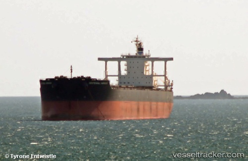
Centennial Harmony
Current StatusWhere is the vessel?
Centennial Harmony is currently in 41 nm NW of KAHYANGAN, based on AIS data received about 15h ago.
Latest AIS update:
Current position: 7.97440° S, 116.19837° E (41 nm NW of KAHYANGAN)
Average speed (last 7 days): Loading…
Average speed (last 30 days): Loading…
Vessel profile: Centennial Harmony is a Bulk Carrier with dimensions 45m x 292m.
This page combines live AIS, route history, probable destination signals, nearby traffic, and port activity for practical vessel monitoring.
The current position of vessel Centennial Harmony is -7.97440 lat / 116.19837 lng. Updated: 2026-05-18 11:30:51 UTCNearest reference points:
- Near LEMBAR
- 29 nm N of MANGGIS
- 37 nm E of Pagerungan
Details:
Live Vessel Centennial Harmony Analytics (details, animations, etc.)
Recent AIS points (UTC):
2026-05-18 07:55:51 UTC · -8.48413, 115.84231 · SOG 10.1 kn · COG 22°2026-05-18 09:26:11 UTC · -8.26498, 115.95565 · SOG 10 kn · COG 38°
2026-05-18 10:25:22 UTC · -8.13031, 116.06412 · SOG 11.3 kn · COG 40°
2026-05-18 11:30:51 UTC · -7.97440, 116.19837 · SOG 11.4 kn · COG 42°