 vesseltracker.com
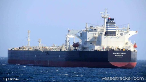
Aqualegend
Current StatusWhere is the vessel?
Aqualegend is currently in 65 nm N of South Riding Point, based on AIS data received about 14h ago.
Latest AIS update:
Current position: 27.68786° N, 78.36259° W (65 nm N of South Riding Point)
Average speed (last 7 days): Loading…
Average speed (last 30 days): Loading…
Vessel profile: Aqualegend is a Crude Oil Tanker with dimensions 45m x 249m.
This page combines live AIS, route history, probable destination signals, nearby traffic, and port activity for practical vessel monitoring.
The current position of vessel Aqualegend is 27.68786 lat / -78.36259 lng. Updated: 2026-05-17 22:17:26 UTCNearest reference points:
- 75 nm N of Green Turtle Cay
- Near Green Turtle Cay
- Near Juno Beach
Details:
Live Vessel Aqualegend Analytics (details, animations, etc.)
Recent AIS points (UTC):
2026-05-17 19:46:44 UTC · 27.55307, -78.92539 · SOG 12 kn · COG 75°2026-05-17 20:11:46 UTC · 27.57308, -78.82906 · SOG 12.3 kn · COG 75°
2026-05-17 20:48:26 UTC · 27.61198, -78.69360 · SOG 12.8 kn · COG 76°
2026-05-17 22:17:26 UTC · 27.68786, -78.36259 · SOG 11.7 kn · COG 79°