 vesseltracker.com
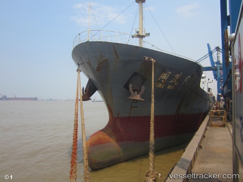
 Tong Mao 9
Current Status
Where is the vessel?
Tong Mao 9 is currently in Near Xiaocuo Pt, based on AIS data received about 14h ago.
Latest AIS update:
Current position: 25.27108° N, 119.96384° E (Near Xiaocuo Pt)
Average speed (last 7 days): Loading…
Average speed (last 30 days): Loading…
Vessel profile: Tong Mao 9 is a General Cargo Ship with dimensions 112m x 17m.
This page combines live AIS, route history, probable destination signals, nearby traffic, and port activity for practical vessel monitoring.
The current position of vessel Tong Mao 9 is 25.27108 lat / 119.96384 lng. Updated: 2026-05-18 00:01:00 UTCNearest reference points:
- 10 nm N of Xiaocuo Pt
- Near Jinjing
- Near Damaiyu
Currently sailing under the flag of China ![]()
Details:
Live Vessel Tong Mao 9 Analytics (details, animations, etc.)
Recent AIS points (UTC):
2026-05-17 21:29:10 UTC · 25.49000, 120.33667 · SOG 8 kn · COG -1°2026-05-17 23:05:10 UTC · 25.34667, 120.10833 · SOG 9 kn · COG -1°
2026-05-17 23:44:11 UTC · 25.29403, 120.00797 · SOG 9.7 kn · COG 239°
2026-05-18 00:01:00 UTC · 25.27108, 119.96384 · SOG 9 kn · COG 239°