 IRIS
IRIS
Current Status
Where is the vessel?
IRIS is currently in Near Haifa, based on AIS data received about 15h ago.
Latest AIS update:
Current position: 32.81947° N, 35.00601° E (Near Haifa)
Average speed (last 7 days): Loading…
Average speed (last 30 days): Loading…
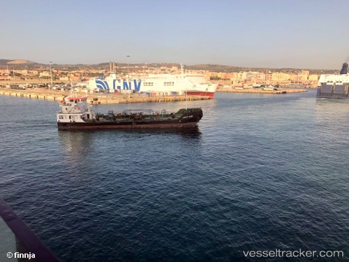
Vessel profile: IRIS is a Bunkering Tanker with dimensions 56m x 20m.
This page combines live AIS, route history, probable destination signals, nearby traffic, and port activity for practical vessel monitoring.
The current position of vessel IRIS is 32.81947 lat / 35.00601 lng. Updated: 2026-05-18 20:02:36 UTCNearest reference points:
- Near Haifa
- 22 nm W of Haifa Granaries
- Near DBAIYEH
Currently sailing under the flag of Cyprus ![]()
IRIS built in 2010 year
Deadweight:
1851 tDetails:
Live Vessel IRIS Analytics (details, animations, etc.)
Recent AIS points (UTC):
2026-05-18 16:35:26 UTC · 32.81919, 35.00645 · SOG 7.7 kn · COG -1°2026-05-18 16:35:26 UTC · 32.81919, 35.00645 · SOG 7.7 kn · COG -1°
2026-05-18 19:31:04 UTC · 32.81947, 35.00605 · SOG 0 kn · COG -1°
2026-05-18 20:02:36 UTC · 32.81947, 35.00601 · SOG 0 kn · COG -1°