 vesseltracker.com
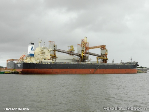
 Chryssa K
Current Status
Where is the vessel?
Chryssa K is currently in 86 nm NW of Trakovice, based on AIS data received about 15h ago.
Latest AIS update:
Current position: 49.29405° N, 168.94943° E (86 nm NW of Trakovice)
Average speed (last 7 days): Loading…
Average speed (last 30 days): Loading…
Vessel profile: Chryssa K is a Bulk Carrier with dimensions 229m x 32m.
This page combines live AIS, route history, probable destination signals, nearby traffic, and port activity for practical vessel monitoring.
The current position of vessel Chryssa K is 49.29405 lat / 168.94943 lng. Updated: 2026-05-17 23:51:44 UTCCurrently sailing under the flag of Liberia ![]()
Chryssa K built in 2012 year
Deadweight:
81305 tDetails:
Live Vessel Chryssa K Analytics (details, animations, etc.)
Recent AIS points (UTC):
2026-05-17 19:45:10 UTC · 49.22492, 167.67291 · SOG 12.3 kn · COG 84°2026-05-17 21:35:24 UTC · 49.25332, 168.23878 · SOG 12.2 kn · COG 81°
2026-05-17 22:59:10 UTC · 49.27747, 168.67906 · SOG 12.2 kn · COG 83°
2026-05-17 23:51:44 UTC · 49.29405, 168.94943 · SOG 12.3 kn · COG 83°