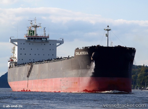
Galateia
Current StatusWhere is the vessel?
Galateia is currently in 373 nm NE of Windermere, based on AIS data received about 15h ago.
Latest AIS update:
Current position: 29.58723° S, 13.27896° W (373 nm NE of Windermere)
Average speed (last 7 days): Loading…
Average speed (last 30 days): Loading…
Vessel profile: Galateia is a Bulk Carrier with dimensions 32m x 229m.
This page combines live AIS, route history, probable destination signals, nearby traffic, and port activity for practical vessel monitoring.
The current position of vessel Galateia is -29.58723 lat / -13.27896 lng. Updated: 2026-05-18 17:58:44 UTCNearest reference points:
- Open sea, approx. 400 nm off the nearest listed port
- Open sea, approx. 402 nm off the nearest listed port
- Open sea, approx. 401 nm off the nearest listed port
Details:
Live Vessel Galateia Analytics (details, animations, etc.)
Recent AIS points (UTC):
2026-05-18 14:03:04 UTC · -29.68137, -12.42520 · SOG 11.2 kn · COG 280°2026-05-18 16:17:33 UTC · -29.62932, -12.90749 · SOG 11.6 kn · COG 278°
2026-05-18 16:24:25 UTC · -29.62648, -12.93273 · SOG 11.7 kn · COG 278°
2026-05-18 17:58:44 UTC · -29.58723, -13.27896 · SOG 11.7 kn · COG 279°