 SEAHOPE
Current Status
Where is the vessel?
SEAHOPE is currently in 211 nm NE of Fernando De Noronha, based on AIS data received about 15h ago.
Latest AIS update:
Current position: 0.97167° S, 30.38167° W (211 nm NE of Fernando De Noronha)
Average speed (last 7 days): Loading…
Average speed (last 30 days): Loading…
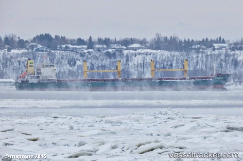
Vessel profile: SEAHOPE is a Bulk Carrier with dimensions 178m x 28m.
This page combines live AIS, route history, probable destination signals, nearby traffic, and port activity for practical vessel monitoring.
The current position of vessel SEAHOPE is -0.97167 lat / -30.38167 lng. Updated: 2026-05-18 17:44:52 UTCCurrently sailing under the flag of Marshall Islands ![]()
SEAHOPE built in 2012 year
Deadweight:
32922 tDetails:
Live Vessel SEAHOPE Analytics (details, animations, etc.)
Recent AIS points (UTC):
2026-05-18 13:20:51 UTC · -0.15333, -30.07833 · SOG 11 kn · COG -1°2026-05-18 15:53:49 UTC · -0.62667, -30.25667 · SOG 11 kn · COG -1°
2026-05-18 16:02:50 UTC · -0.65333, -30.26833 · SOG 11 kn · COG -1°
2026-05-18 17:44:52 UTC · -0.97167, -30.38167 · SOG 12 kn · COG -1°