 vesseltracker.com
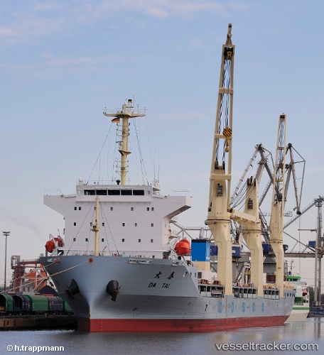
 DA TAI
Current Status
Where is the vessel?
DA TAI is currently in 22 nm NE of Lü-hua Shan, based on AIS data received about 14h ago.
Latest AIS update:
Current position: 31.11765° N, 122.85979° E (22 nm NE of Lü-hua Shan)
Average speed (last 7 days): Loading…
Average speed (last 30 days): Loading…
Vessel profile: DA TAI is a General Cargo with dimensions m x m.
This page combines live AIS, route history, probable destination signals, nearby traffic, and port activity for practical vessel monitoring.
The current position of vessel DA TAI is 31.11765 lat / 122.85979 lng. Updated: 2026-05-18 14:12:01 UTCNearest reference points:
- 21 nm NE of Lü-hua Shan
- 19 nm NE of Lü-hua Shan
- 14 nm N of Lü-hua Shan
Currently sailing under the flag of Singapore ![]()
Details:
Live Vessel DA TAI Analytics (details, animations, etc.)
Recent AIS points (UTC):
2026-05-18 10:53:51 UTC · 30.85524, 123.51255 · SOG 11.8 kn · COG 345°2026-05-18 11:49:01 UTC · 30.99615, 123.39277 · SOG 12.7 kn · COG 286°
2026-05-18 13:40:22 UTC · 31.10906, 122.99559 · SOG 13 kn · COG 270°
2026-05-18 14:12:01 UTC · 31.11765, 122.85979 · SOG 13.5 kn · COG 265°