 vesseltracker.com
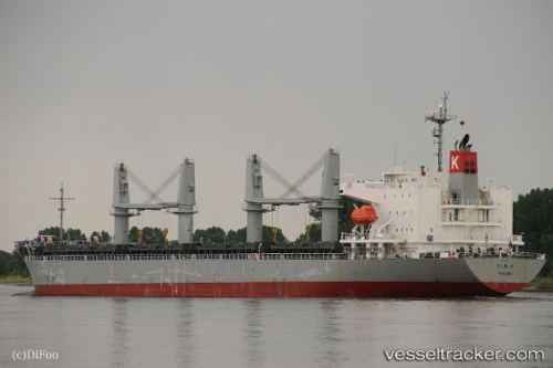
Elm K
Current StatusWhere is the vessel?
Elm K is currently in 20 nm SE of Kings Bromley, based on AIS data received about 14h ago.
Latest AIS update:
Current position: 52.51148° N, 148.60493° W (20 nm SE of Kings Bromley)
Average speed (last 7 days): Loading…
Average speed (last 30 days): Loading…
Vessel profile: Elm K is a General Cargo Ship with dimensions 28m x 181m.
This page combines live AIS, route history, probable destination signals, nearby traffic, and port activity for practical vessel monitoring.
The current position of vessel Elm K is 52.51148 lat / -148.60493 lng. Updated: 2026-05-17 21:35:55 UTCDetails:
Live Vessel Elm K Analytics (details, animations, etc.)
Recent AIS points (UTC):
2026-05-17 17:29:26 UTC · 52.35600, -147.66702 · SOG 8.9 kn · COG 279°2026-05-17 19:26:32 UTC · 52.43433, -148.09842 · SOG 7.4 kn · COG 280°
2026-05-17 19:42:14 UTC · 52.44405, -148.15903 · SOG 9.2 kn · COG 279°
2026-05-17 21:35:55 UTC · 52.51148, -148.60493 · SOG 9 kn · COG 280°