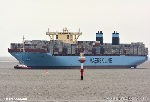
 MARY MAERSK
Current Status
Where is the vessel?
MARY MAERSK is currently in 16 nm W of Tai-tung Kang, based on AIS data received about 15h ago.
Latest AIS update:
Current position: 24.24923° N, 120.19953° E (16 nm W of Tai-tung Kang)
Average speed (last 7 days): Loading…
Average speed (last 30 days): Loading…
Vessel profile: MARY MAERSK is a Container Ship with dimensions 399m x 59m.
This page combines live AIS, route history, probable destination signals, nearby traffic, and port activity for practical vessel monitoring.
The current position of vessel MARY MAERSK is 24.24923 lat / 120.19953 lng. Updated: 2026-05-20 05:38:35 UTCNearest reference points:
- Near Tai-tung Kang
- Near TAICHUNG
- Near MAILIAO
Currently sailing under the flag of Denmark ![]()
MARY MAERSK built in 2013 year
Deadweight:
213970 tDetails:
Live Vessel MARY MAERSK Analytics (details, animations, etc.)
Recent AIS points (UTC):
2026-05-20 02:05:49 UTC · 23.32663, 119.83232 · SOG 18.8 kn · COG 0°2026-05-20 02:16:35 UTC · 23.38372, 119.83498 · SOG 19.3 kn · COG 0°
2026-05-20 03:42:35 UTC · 23.84133, 119.90957 · SOG 16.7 kn · COG 22°
2026-05-20 05:38:35 UTC · 24.24923, 120.19953 · SOG 14.1 kn · COG 33°