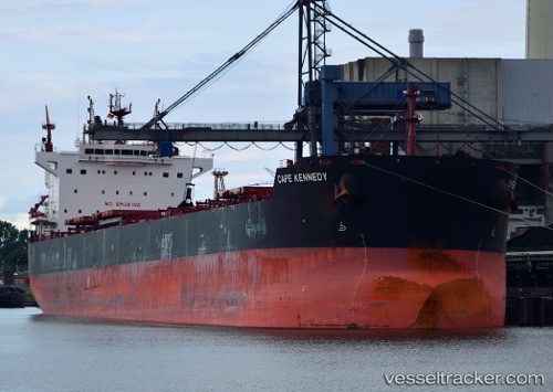
Cape Kennedy
Current StatusWhere is the vessel?
Cape Kennedy is currently in 43 nm SE of ZHOUSHAN, based on AIS data received about 15h ago.
Latest AIS update:
Current position: 29.61049° N, 122.91829° E (43 nm SE of ZHOUSHAN)
Average speed (last 7 days): Loading…
Average speed (last 30 days): Loading…
Vessel profile: Cape Kennedy is a Bulk Carrier with dimensions 32m x 229m.
This page combines live AIS, route history, probable destination signals, nearby traffic, and port activity for practical vessel monitoring.
The current position of vessel Cape Kennedy is 29.61049 lat / 122.91829 lng. Updated: 2026-06-04 04:34:38 UTCNearest reference points:
- 41 nm SE of ZHOUSHAN
- 42 nm SE of ZHOUSHAN
- 44 nm SE of ZHOUSHAN
Details:
Live Vessel Cape Kennedy Analytics (details, animations, etc.)
Recent AIS points (UTC):
2026-06-04 03:40:53 UTC · 29.61248, 122.91981 · SOG 0.1 kn · COG 223°2026-06-04 03:40:53 UTC · 29.61248, 122.91981 · SOG 0.1 kn · COG 223°
2026-06-04 04:34:38 UTC · 29.61049, 122.91829 · SOG 1.7 kn · COG 235°
2026-06-04 04:34:38 UTC · 29.61049, 122.91829 · SOG 1.7 kn · COG 235°