 vesseltracker.com
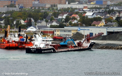
 Helene H
Current Status
Where is the vessel?
Helene H is currently in Near HENNINGSVAR, based on AIS data received less than 1h ago.
Latest AIS update:
Current position: 68.15555° N, 14.13404° E (Near HENNINGSVAR)
Average speed (last 7 days): Loading…
Average speed (last 30 days): Loading…
Vessel profile: Helene H is a Multi Purpose Carrier with dimensions 69m x 13m.
This page combines live AIS, route history, probable destination signals, nearby traffic, and port activity for practical vessel monitoring.
The current position of vessel Helene H is 68.15555 lat / 14.13404 lng. Updated: 2026-05-17 19:33:15 UTCNearest reference points:
- Near SVOLVAER
- Near Berrvik (Bergvik)
- Near Misten
Currently sailing under the flag of Norway ![]()
Helene H built in 2013 year
Deadweight:
2396 tDetails:
Live Vessel Helene H Analytics (details, animations, etc.)
Recent AIS points (UTC):
2026-05-17 15:59:25 UTC · 68.53859, 15.08203 · SOG 9.7 kn · COG 220°2026-05-17 16:15:46 UTC · 68.50755, 14.99573 · SOG 9.6 kn · COG 228°
2026-05-17 18:07:16 UTC · 68.36851, 14.31419 · SOG 8.8 kn · COG 214°
2026-05-17 19:33:15 UTC · 68.15555, 14.13404 · SOG 9.3 kn · COG 217°