 vesseltracker.com
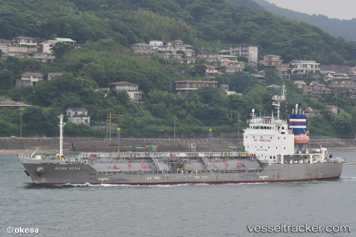
Buena Reina
Current StatusWhere is the vessel?
Buena Reina is currently in 149 nm SE of Xijiang, based on AIS data received about 14h ago.
Latest AIS update:
Current position: 20.07833° N, 117.18500° E (149 nm SE of Xijiang)
Average speed (last 7 days): Loading…
Average speed (last 30 days): Loading…
Vessel profile: Buena Reina is a Lpg Tanker with dimensions 16m x 96m.
This page combines live AIS, route history, probable destination signals, nearby traffic, and port activity for practical vessel monitoring.
The current position of vessel Buena Reina is 20.07833 lat / 117.18500 lng. Updated: 2026-05-18 03:36:17 UTCNearest reference points:
- 148 nm SE of Xijiang
- 64 nm SE of Jiazi
- 53 nm S of Jiazi
Details:
Live Vessel Buena Reina Analytics (details, animations, etc.)
Recent AIS points (UTC):
2026-05-18 01:33:15 UTC · 19.76500, 116.98167 · SOG 10 kn · COG -1°2026-05-18 01:42:19 UTC · 19.78667, 116.99667 · SOG 9 kn · COG -1°
2026-05-18 03:30:17 UTC · 20.06167, 117.17500 · SOG 11 kn · COG -1°
2026-05-18 03:36:17 UTC · 20.07833, 117.18500 · SOG 9 kn · COG -1°