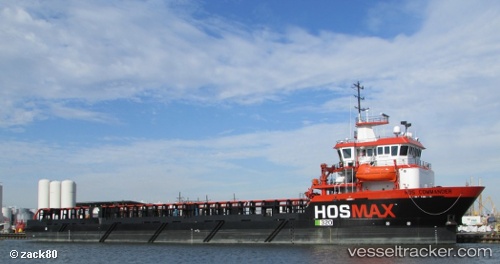
 Hos Commander
Current Status
Where is the vessel?
Hos Commander is currently in Near FOURCHON, based on AIS data received about 15h ago.
Latest AIS update:
Current position: 29.14338° N, 90.21712° W (Near FOURCHON)
Average speed (last 7 days): Loading…
Average speed (last 30 days): Loading…
Vessel profile: Hos Commander is a Offshore Tug Supply Ship with dimensions 100m x 20m.
This page combines live AIS, route history, probable destination signals, nearby traffic, and port activity for practical vessel monitoring.
The current position of vessel Hos Commander is 29.14338 lat / -90.21712 lng. Updated: 2026-05-20 08:08:57 UTCNearest reference points:
- Near FOURCHON
- Near Port Fourchon
- Near Pointe a la Hache
Currently sailing under the flag of USA ![]()
Hos Commander built in 2013 year
Deadweight:
6143 tDetails:
Live Vessel Hos Commander Analytics (details, animations, etc.)
Recent AIS points (UTC):
2026-05-20 04:44:56 UTC · 29.14336, -90.21714 · SOG 0 kn · COG 251°2026-05-20 06:11:56 UTC · 29.14335, -90.21714 · SOG 0 kn · COG 251°
2026-05-20 08:02:57 UTC · 29.14335, -90.21713 · SOG 0 kn · COG 251°
2026-05-20 08:08:57 UTC · 29.14338, -90.21712 · SOG 0 kn · COG 251°