 vesseltracker.com
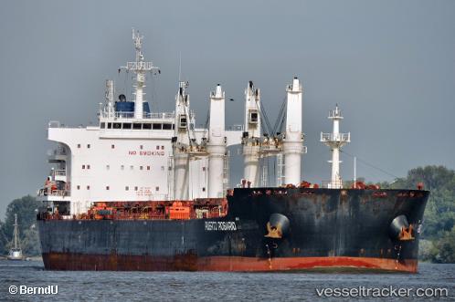
 PUERTO ROSARIO
Current Status
Where is the vessel?
PUERTO ROSARIO is currently in 221 nm SW of Keti Bandar, based on AIS data received about 14h ago.
Latest AIS update:
Current position: 21.50282° N, 64.64320° E (221 nm SW of Keti Bandar)
Average speed (last 7 days): Loading…
Average speed (last 30 days): Loading…
Vessel profile: PUERTO ROSARIO is a Bulk Carrier with dimensions 32m x 200m.
This page combines live AIS, route history, probable destination signals, nearby traffic, and port activity for practical vessel monitoring.
The current position of vessel PUERTO ROSARIO is 21.50282 lat / 64.64320 lng. Updated: 2026-05-18 04:15:39 UTCNearest reference points:
- 231 nm SW of Keti Bandar
- 224 nm E of SUR
- 262 nm SE of SUR
Currently sailing under the flag of Panama ![]()
PUERTO ROSARIO built in 2014 year
Deadweight:
64689 tDetails:
Live Vessel PUERTO ROSARIO Analytics (details, animations, etc.)
Recent AIS points (UTC):
2026-05-18 01:14:59 UTC · 21.61750, 64.82438 · SOG 1.9 kn · COG 338°2026-05-18 01:55:29 UTC · 21.63963, 64.82980 · SOG 2.4 kn · COG 342°
2026-05-18 04:10:19 UTC · 21.50630, 64.64378 · SOG 3.1 kn · COG 209°
2026-05-18 04:15:39 UTC · 21.50282, 64.64320 · SOG 2.2 kn · COG 178°