 vesseltracker.com
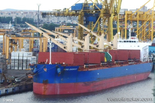
 UNITY ADVENTURE
Current Status
Where is the vessel?
UNITY ADVENTURE is currently in Near Port Elizabeth, based on AIS data received about 14h ago.
Latest AIS update:
Current position: 33.88451° S, 25.76081° E (Near Port Elizabeth)
Average speed (last 7 days): Loading…
Average speed (last 30 days): Loading…
Vessel profile: UNITY ADVENTURE is a Cargo with dimensions m x m.
This page combines live AIS, route history, probable destination signals, nearby traffic, and port activity for practical vessel monitoring.
The current position of vessel UNITY ADVENTURE is -33.88451 lat / 25.76081 lng. Updated: 2026-05-17 23:05:20 UTCNearest reference points:
- Near Deal Party
- 21 nm S of Mount Pleasant
Currently sailing under the flag of Bahamas ![]()
Details:
Live Vessel UNITY ADVENTURE Analytics (details, animations, etc.)
Recent AIS points (UTC):
2026-05-17 19:08:21 UTC · -33.88398, 25.76010 · SOG 0.1 kn · COG 70°2026-05-17 19:32:20 UTC · -33.88417, 25.76027 · SOG 0 kn · COG 60°
2026-05-17 21:53:20 UTC · -33.88429, 25.76030 · SOG 0.3 kn · COG 58°
2026-05-17 23:05:20 UTC · -33.88451, 25.76081 · SOG 0 kn · COG 38°