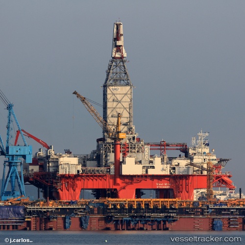
 West Mira
Current Status
Where is the vessel?
West Mira is currently in 180 nm W of Koiingnaas, based on AIS data received about 15h ago.
Latest AIS update:
Current position: 29.56270° S, 13.91235° E (180 nm W of Koiingnaas)
Average speed (last 7 days): Loading…
Average speed (last 30 days): Loading…
Vessel profile: West Mira is a Drilling Ship with dimensions 125m x 125m.
This page combines live AIS, route history, probable destination signals, nearby traffic, and port activity for practical vessel monitoring.
The current position of vessel West Mira is -29.56270 lat / 13.91235 lng. Updated: 2026-05-18 17:32:47 UTCNearest reference points:
- 161 nm W of Koiingnaas
- 154 nm W of Koiingnaas
- 167 nm SW of Koiingnaas
Currently sailing under the flag of Norway ![]()
Details:
Live Vessel West Mira Analytics (details, animations, etc.)
Recent AIS points (UTC):
2026-05-18 14:13:29 UTC · -29.56274, 13.91237 · SOG 0 kn · COG 160°2026-05-18 15:46:10 UTC · -29.56271, 13.91237 · SOG 0.1 kn · COG 160°
2026-05-18 16:34:28 UTC · -29.56271, 13.91236 · SOG 0 kn · COG 160°
2026-05-18 17:32:47 UTC · -29.56270, 13.91235 · SOG 0.1 kn · COG 160°