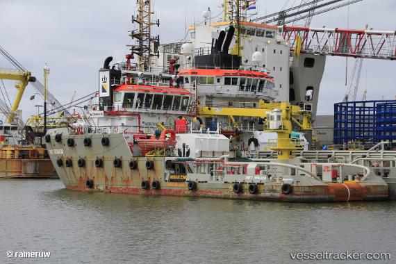
 SEA SERAYA
Current Status
Where is the vessel?
SEA SERAYA is currently in 20 nm NE of Banes, based on AIS data received about 14h ago.
Latest AIS update:
Current position: 21.08000° N, 75.38500° W (20 nm NE of Banes)
Average speed (last 7 days): Loading…
Average speed (last 30 days): Loading…
Vessel profile: SEA SERAYA is a Anchor Handling Vessel with dimensions m x m.
This page combines live AIS, route history, probable destination signals, nearby traffic, and port activity for practical vessel monitoring.
The current position of vessel SEA SERAYA is 21.08000 lat / -75.38500 lng. Updated: 2026-05-20 04:40:00 UTCNearest reference points:
- 16 nm SE of Ceiba Hueca
- Near Great Exuma Island
- 36 nm E of Cayo Coco
Currently sailing under the flag of Netherlands ![]()
Details:
Live Vessel SEA SERAYA Analytics (details, animations, etc.)
Recent AIS points (UTC):
2026-05-20 01:31:02 UTC · 21.28667, -75.79167 · SOG 8 kn · COG -1°2026-05-20 02:16:00 UTC · 21.22833, -75.69500 · SOG 8 kn · COG -1°
2026-05-20 03:49:03 UTC · 21.13667, -75.49166 · SOG 8 kn · COG -1°
2026-05-20 04:40:00 UTC · 21.08000, -75.38500 · SOG 8 kn · COG -1°