 Gravity Highway
Current Status
Where is the vessel?
Gravity Highway is currently in 21 nm E of Londolovit, based on AIS data received about 14h ago.
Latest AIS update:
Current position: 3.06535° S, 152.96259° E (21 nm E of Londolovit)
Average speed (last 7 days): Loading…
Average speed (last 30 days): Loading…
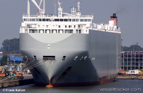
Vessel profile: Gravity Highway is a Vehicles Carrier with dimensions 200m x 32m.
This page combines live AIS, route history, probable destination signals, nearby traffic, and port activity for practical vessel monitoring.
The current position of vessel Gravity Highway is -3.06535 lat / 152.96259 lng. Updated: 2026-05-19 19:42:41 UTCNearest reference points:
- Near Rabaul
- 15 nm SW of Lambom Island
Currently sailing under the flag of Bahamas ![]()
Gravity Highway built in 2014 year
Deadweight:
19974 tDetails:
Live Vessel Gravity Highway Analytics (details, animations, etc.)
Recent AIS points (UTC):
2026-05-19 16:24:40 UTC · -3.84367, 153.09930 · SOG 15.5 kn · COG 328°2026-05-19 18:23:33 UTC · -3.38833, 152.91167 · SOG 14 kn · COG -1°
2026-05-19 19:20:39 UTC · -3.15500, 152.94501 · SOG 15 kn · COG -1°
2026-05-19 19:42:41 UTC · -3.06535, 152.96259 · SOG 15 kn · COG 12°