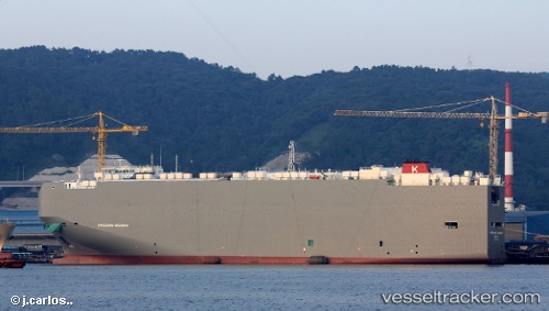
Hyperion Highway
Current StatusWhere is the vessel?
Hyperion Highway is currently in 76 nm SE of Zhuangyuanao, based on AIS data received about 14h ago.
Latest AIS update:
Current position: 26.76137° N, 121.77375° E (76 nm SE of Zhuangyuanao)
Average speed (last 7 days): Loading…
Average speed (last 30 days): Loading…
Vessel profile: Hyperion Highway is a Vehicles Carrier with dimensions 36m x 200m.
This page combines live AIS, route history, probable destination signals, nearby traffic, and port activity for practical vessel monitoring.
The current position of vessel Hyperion Highway is 26.76137 lat / 121.77375 lng. Updated: 2026-05-19 03:39:24 UTCNearest reference points:
- 66 nm SE of Sansha
- 41 nm E of Xiangyu Terminal/ Xiamen
- 36 nm SE of Zhuangyuanao
Details:
Live Vessel Hyperion Highway Analytics (details, animations, etc.)
Recent AIS points (UTC):
2026-05-18 23:22:41 UTC · 27.89005, 122.41394 · SOG 17.3 kn · COG 203°2026-05-19 01:40:59 UTC · 27.28695, 122.05481 · SOG 17.6 kn · COG 194°
2026-05-19 02:01:35 UTC · 27.18923, 122.02550 · SOG 17.4 kn · COG 194°
2026-05-19 03:39:24 UTC · 26.76137, 121.77375 · SOG 18.1 kn · COG -1°