 vesseltracker.com
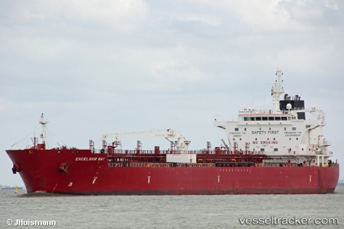
 Excelsior Bay
Current Status
Where is the vessel?
Excelsior Bay is currently in 115 nm SW of Monrovia, based on AIS data received about 14h ago.
Latest AIS update:
Current position: 5.19242° N, 12.36428° W (115 nm SW of Monrovia)
Average speed (last 7 days): Loading…
Average speed (last 30 days): Loading…
Vessel profile: Excelsior Bay is a Chemical Oil Products Tanker with dimensions 183m x 32m.
This page combines live AIS, route history, probable destination signals, nearby traffic, and port activity for practical vessel monitoring.
The current position of vessel Excelsior Bay is 5.19242 lat / -12.36428 lng. Updated: 2026-05-18 07:02:27 UTCNearest reference points:
- 126 nm SW of YORK
- 15 nm SW of Buchanan
- 110 nm SW of River Cess
Currently sailing under the flag of Marshall Is ![]()
Details:
Live Vessel Excelsior Bay Analytics (details, animations, etc.)
Recent AIS points (UTC):
2026-05-18 03:59:36 UTC · 4.88641, -11.85442 · SOG 11.7 kn · COG 301°2026-05-18 04:53:07 UTC · 4.97906, -12.00292 · SOG 11.6 kn · COG 300°
2026-05-18 05:42:06 UTC · 5.06350, -12.13806 · SOG 11.7 kn · COG 300°
2026-05-18 07:02:27 UTC · 5.19242, -12.36428 · SOG 11.6 kn · COG 298°