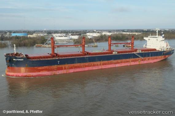
 BELFOREST
Current Status
Where is the vessel?
BELFOREST is currently in Open sea (no nearby ports in database), based on AIS data received about 14h ago.
Latest AIS update:
Current position: 33.93366° S, 82.87534° E (Open sea (no nearby ports in database))
Average speed (last 7 days): Loading…
Average speed (last 30 days): Loading…
Vessel profile: BELFOREST is a Bulk Carrier with dimensions 200m x 32m.
This page combines live AIS, route history, probable destination signals, nearby traffic, and port activity for practical vessel monitoring.
The current position of vessel BELFOREST is -33.93366 lat / 82.87534 lng. Updated: 2026-05-19 04:25:17 UTCNearest reference points:
- Open sea (no nearby ports in database)
Currently sailing under the flag of Norway (NIS) ![]()
BELFOREST built in 2015 year
Deadweight:
61252 tDetails:
Live Vessel BELFOREST Analytics (details, animations, etc.)
Recent AIS points (UTC):
2026-05-19 01:24:15 UTC · -33.94334, 83.46428 · SOG 9.5 kn · COG 267°2026-05-19 02:29:24 UTC · -33.94630, 83.24975 · SOG 9.6 kn · COG 269°
2026-05-19 04:17:04 UTC · -33.93480, 82.90087 · SOG 9.5 kn · COG 271°
2026-05-19 04:25:17 UTC · -33.93366, 82.87534 · SOG 9.1 kn · COG 272°