 vesseltracker.com
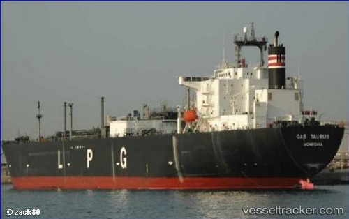
 GAS QUILA
Current Status
Where is the vessel?
GAS QUILA is currently in 149 nm SW of Los Cabos, based on AIS data received about 14h ago.
Latest AIS update:
Current position: 20.80548° N, 111.38403° W (149 nm SW of Los Cabos)
Average speed (last 7 days): Loading…
Average speed (last 30 days): Loading…
Vessel profile: GAS QUILA is a Tanker with dimensions m x m.
This page combines live AIS, route history, probable destination signals, nearby traffic, and port activity for practical vessel monitoring.
The current position of vessel GAS QUILA is 20.80548 lat / -111.38403 lng. Updated: 2026-05-18 01:55:23 UTCNearest reference points:
- 99 nm SE of Shitan
- 69 nm W of Los Cabos
- 71 nm W of Los Cabos
Currently sailing under the flag of Indonesia ![]()
Details:
Live Vessel GAS QUILA Analytics (details, animations, etc.)
Recent AIS points (UTC):
2026-05-17 22:57:41 UTC · 21.28556, -112.04140 · SOG 15.9 kn · COG 128°2026-05-17 23:48:29 UTC · 21.14985, -111.85335 · SOG 15.8 kn · COG 125°
2026-05-18 01:29:11 UTC · 20.87123, -111.48587 · SOG 15.8 kn · COG 123°
2026-05-18 01:55:23 UTC · 20.80548, -111.38403 · SOG 16 kn · COG 123°