 vesseltracker.com
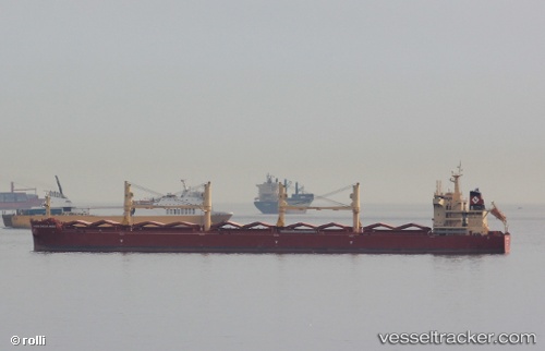
 ELEKTRA
Current Status
Where is the vessel?
ELEKTRA is currently in 55 nm W of Cap Skiring, based on AIS data received about 16h ago.
Latest AIS update:
Current position: 12.47358° N, 17.68250° W (55 nm W of Cap Skiring)
Average speed (last 7 days): Loading…
Average speed (last 30 days): Loading…
Vessel profile: ELEKTRA is a Cargo with dimensions m x m.
This page combines live AIS, route history, probable destination signals, nearby traffic, and port activity for practical vessel monitoring.
The current position of vessel ELEKTRA is 12.47358 lat / -17.68250 lng. Updated: 2026-05-18 01:35:50 UTCNearest reference points:
- 48 nm W of Cap Skiring
- Near San Francisco Libre
- Near Banjul
Details:
Live Vessel ELEKTRA Analytics (details, animations, etc.)
Recent AIS points (UTC):
2026-05-17 22:21:29 UTC · 13.06729, -17.77651 · SOG 11.7 kn · COG 176°2026-05-17 23:29:42 UTC · 12.85570, -17.74183 · SOG 11.1 kn · COG 172°
2026-05-18 01:30:00 UTC · 12.49121, -17.68470 · SOG 10.9 kn · COG 170°
2026-05-18 01:35:50 UTC · 12.47358, -17.68250 · SOG 10.8 kn · COG 173°