 vesseltracker.com
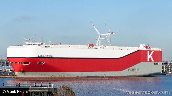
 Global Highway
Current Status
Where is the vessel?
Global Highway is currently in 252 nm SE of Richards Bay, based on AIS data received about 14h ago.
Latest AIS update:
Current position: 31.32308° S, 36.05510° E (252 nm SE of Richards Bay)
Average speed (last 7 days): Loading…
Average speed (last 30 days): Loading…
Vessel profile: Global Highway is a Vehicles Carrier with dimensions 199m x 199m.
This page combines live AIS, route history, probable destination signals, nearby traffic, and port activity for practical vessel monitoring.
The current position of vessel Global Highway is -31.32308 lat / 36.05510 lng. Updated: 2026-05-18 12:07:24 UTCNearest reference points:
- 163 nm SE of Richards Bay
- 181 nm SE of Hibberdene
- Open sea, approx. 401 nm off the nearest listed port
Currently sailing under the flag of Panama ![]()
Details:
Live Vessel Global Highway Analytics (details, animations, etc.)
Recent AIS points (UTC):
2026-05-18 07:44:06 UTC · -30.89500, 37.27833 · SOG 14 kn · COG -1°2026-05-18 09:44:33 UTC · -31.09745, 36.74626 · SOG 15.9 kn · COG 246°
2026-05-18 10:32:15 UTC · -31.18019, 36.51994 · SOG 15.9 kn · COG 248°
2026-05-18 12:07:24 UTC · -31.32308, 36.05510 · SOG 15.9 kn · COG 256°