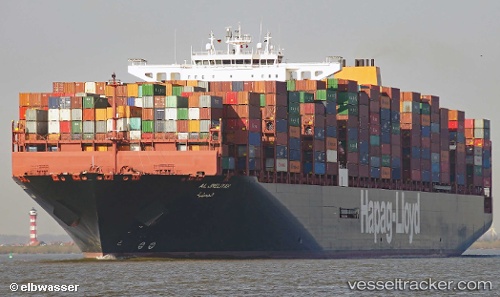
 AL JMELIYAH
Current Status
Where is the vessel?
AL JMELIYAH is currently in 72 nm SE of Juan Grande, based on AIS data received about 14h ago.
Latest AIS update:
Current position: 26.75195° N, 14.80786° W (72 nm SE of Juan Grande)
Average speed (last 7 days): Loading…
Average speed (last 30 days): Loading…
Vessel profile: AL JMELIYAH is a Cargo A with dimensions m x m.
This page combines live AIS, route history, probable destination signals, nearby traffic, and port activity for practical vessel monitoring.
The current position of vessel AL JMELIYAH is 26.75195 lat / -14.80786 lng. Updated: 2026-05-19 04:49:51 UTCNearest reference points:
- Near TALIARTE
- Near Aaiun
- 33 nm SE of San Agustin
Currently sailing under the flag of Germany ![]()
Details:
Live Vessel AL JMELIYAH Analytics (details, animations, etc.)
Recent AIS points (UTC):
2026-05-19 01:25:00 UTC · 25.95675, -15.45102 · SOG 17.5 kn · COG 36°2026-05-19 01:25:00 UTC · 25.95675, -15.45102 · SOG 17.5 kn · COG 36°
2026-05-19 03:27:47 UTC · 26.43473, -15.06925 · SOG 17.3 kn · COG 36°
2026-05-19 04:49:51 UTC · 26.75195, -14.80786 · SOG 17.7 kn · COG -1°