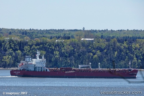
Hafnia Kirsten
Current StatusWhere is the vessel?
Hafnia Kirsten is currently in 137 nm SE of Port Eads, based on AIS data received about 20h ago.
Latest AIS update:
Current position: 26.89513° N, 88.16374° W (137 nm SE of Port Eads)
Average speed (last 7 days): Loading…
Average speed (last 30 days): Loading…
Vessel profile: Hafnia Kirsten is a Chemical Oil Products Tanker with dimensions 32m x 183m.
This page combines live AIS, route history, probable destination signals, nearby traffic, and port activity for practical vessel monitoring.
The current position of vessel Hafnia Kirsten is 26.89513 lat / -88.16374 lng. Updated: 2026-05-18 17:45:33 UTCNearest reference points:
- Near Pilottown
- 13 nm NE of Pilottown
- Near Port Fourchon
Details:
Live Vessel Hafnia Kirsten Analytics (details, animations, etc.)
Recent AIS points (UTC):
2026-05-18 17:45:33 UTC · 26.89513, -88.16374 · SOG 14 kn · COG 333°2026-05-18 17:45:33 UTC · 26.89513, -88.16374 · SOG 14 kn · COG 333°
2026-05-18 17:45:33 UTC · 26.89513, -88.16374 · SOG 14 kn · COG 333°
2026-05-18 17:45:33 UTC · 26.89513, -88.16374 · SOG 14 kn · COG 333°