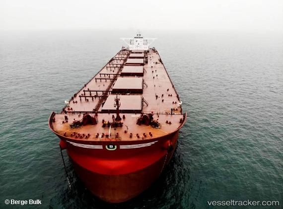
Berge Mafadi
Current StatusWhere is the vessel?
Berge Mafadi is currently in 382 nm W of Luderitz Bay, based on AIS data received about 14h ago.
Latest AIS update:
Current position: 28.88237° S, 8.41329° E (382 nm W of Luderitz Bay)
Average speed (last 7 days): Loading…
Average speed (last 30 days): Loading…
Vessel profile: Berge Mafadi is a Ore Carrier with dimensions 57m x 328m.
This page combines live AIS, route history, probable destination signals, nearby traffic, and port activity for practical vessel monitoring.
The current position of vessel Berge Mafadi is -28.88237 lat / 8.41329 lng. Updated: 2026-05-18 22:58:28 UTCNearest reference points:
- Open sea, approx. 402 nm off the nearest listed port
- Open sea, approx. 400 nm off the nearest listed port
- Open sea, approx. 405 nm off the nearest listed port
Details:
Live Vessel Berge Mafadi Analytics (details, animations, etc.)
Recent AIS points (UTC):
2026-05-18 19:12:38 UTC · -29.36368, 9.13715 · SOG 13.3 kn · COG 306°2026-05-18 20:20:52 UTC · -29.22013, 8.90660 · SOG 12.8 kn · COG 310°
2026-05-18 21:40:17 UTC · -29.05009, 8.65549 · SOG 12.6 kn · COG 309°
2026-05-18 22:58:28 UTC · -28.88237, 8.41329 · SOG 12.5 kn · COG 311°