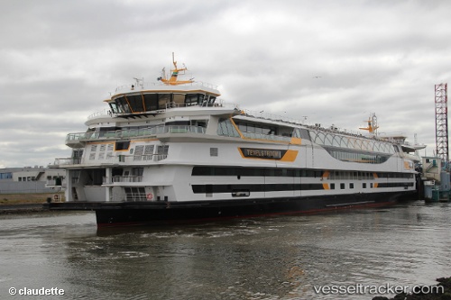
 Texelstroom
Current Status
Where is the vessel?
Texelstroom is currently in Near 't Horntje, based on AIS data received about 14h ago.
Latest AIS update:
Current position: 52.97954° N, 4.78370° E (Near 't Horntje)
Average speed (last 7 days): Loading…
Average speed (last 30 days): Loading…
Vessel profile: Texelstroom is a Passenger Ro Ro Cargo Ship with dimensions 135m x 28m.
This page combines live AIS, route history, probable destination signals, nearby traffic, and port activity for practical vessel monitoring.
The current position of vessel Texelstroom is 52.97954 lat / 4.78370 lng. Updated: 2026-05-19 04:14:08 UTCNearest reference points:
- Near Den Helder
- Near TEXEL
- Near OUDESCHILD
Currently sailing under the flag of Netherlands ![]()
Details:
Live Vessel Texelstroom Analytics (details, animations, etc.)
Recent AIS points (UTC):
2026-05-19 01:21:49 UTC · 53.00349, 4.78155 · SOG 0 kn · COG 319°2026-05-19 01:50:09 UTC · 53.00352, 4.78154 · SOG 0 kn · COG 319°
2026-05-19 04:00:18 UTC · 53.00353, 4.78144 · SOG 0 kn · COG 319°
2026-05-19 04:14:08 UTC · 52.97954, 4.78370 · SOG 9.6 kn · COG 191°