 vesseltracker.com
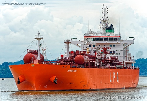
Africa Gas
Current StatusWhere is the vessel?
Africa Gas is currently in 80 nm SW of Greenville, based on AIS data received about 14h ago.
Latest AIS update:
Current position: 3.78871° N, 9.64092° W (80 nm SW of Greenville)
Average speed (last 7 days): Loading…
Average speed (last 30 days): Loading…
Vessel profile: Africa Gas is a Lpg Tanker with dimensions 28m x 180m.
This page combines live AIS, route history, probable destination signals, nearby traffic, and port activity for practical vessel monitoring.
The current position of vessel Africa Gas is 3.78871 lat / -9.64092 lng. Updated: 2026-05-17 22:47:54 UTCNearest reference points:
- 98 nm SW of Harper
- 110 nm SW of River Cess
- 15 nm SW of Buchanan
Details:
Live Vessel Africa Gas Analytics (details, animations, etc.)
Recent AIS points (UTC):
2026-05-17 19:41:01 UTC · 4.22167, -10.29667 · SOG 15 kn · COG -1°2026-05-17 21:50:01 UTC · 3.92167, -9.84333 · SOG 15 kn · COG -1°
2026-05-17 21:50:01 UTC · 3.92167, -9.84333 · SOG 15 kn · COG -1°
2026-05-17 22:47:54 UTC · 3.78871, -9.64092 · SOG 14.9 kn · COG 123°