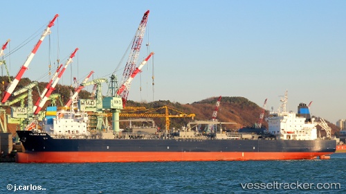
Palanca Miami
Current StatusWhere is the vessel?
Palanca Miami is currently in 36 nm E of Tin Can Bay, based on AIS data received about 15h ago.
Latest AIS update:
Current position: 25.84810° S, 153.67010° E (36 nm E of Tin Can Bay)
Average speed (last 7 days): Loading…
Average speed (last 30 days): Loading…
Vessel profile: Palanca Miami is a Bitumen Tanker with dimensions 32m x 183m.
This page combines live AIS, route history, probable destination signals, nearby traffic, and port activity for practical vessel monitoring.
The current position of vessel Palanca Miami is -25.84810 lat / 153.67010 lng. Updated: 2026-05-18 19:19:51 UTCNearest reference points:
- Near Tin Can Bay
- Near NOOSAVILLE
- Near HERVEY BAY
Details:
Live Vessel Palanca Miami Analytics (details, animations, etc.)
Recent AIS points (UTC):
2026-05-18 16:08:50 UTC · -26.41439, 153.45569 · SOG 11.3 kn · COG 18°2026-05-18 18:08:50 UTC · -26.05773, 153.59363 · SOG 11.3 kn · COG 25°
2026-05-18 19:10:12 UTC · -25.87761, 153.66833 · SOG 11.1 kn · COG 9°
2026-05-18 19:19:51 UTC · -25.84810, 153.67010 · SOG 10.9 kn · COG 5°