 vesseltracker.com
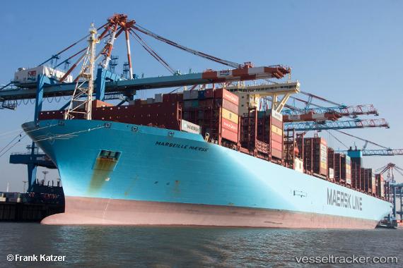
 Marseille Maersk
Current Status
Where is the vessel?
Marseille Maersk is currently in 47 nm W of Blavand, based on AIS data received about 15h ago.
Latest AIS update:
Current position: 55.69833° N, 6.77167° E (47 nm W of Blavand)
Average speed (last 7 days): Loading…
Average speed (last 30 days): Loading…
Vessel profile: Marseille Maersk is a Container Ship with dimensions 399m x 58m.
This page combines live AIS, route history, probable destination signals, nearby traffic, and port activity for practical vessel monitoring.
The current position of vessel Marseille Maersk is 55.69833 lat / 6.77167 lng. Updated: 2026-05-18 07:46:26 UTCNearest reference points:
- 36 nm W of HVIDE SANDE
- Near Blavand
- Near Basel
Currently sailing under the flag of Denmark ![]()
Details:
Live Vessel Marseille Maersk Analytics (details, animations, etc.)
Recent AIS points (UTC):
2026-05-18 04:47:51 UTC · 54.83626, 6.98268 · SOG 18.4 kn · COG 337°2026-05-18 05:33:07 UTC · 55.04592, 6.82143 · SOG 18.3 kn · COG 337°
2026-05-18 07:37:23 UTC · 55.65333, 6.76667 · SOG 18 kn · COG -1°
2026-05-18 07:46:26 UTC · 55.69833, 6.77167 · SOG 18 kn · COG -1°