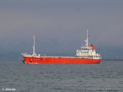
Sireimaru
Current StatusWhere is the vessel?
Sireimaru is currently in Near Nagoya, based on AIS data received about 14h ago.
Latest AIS update:
Current position: 35.06512° N, 136.85999° E (Near Nagoya)
Average speed (last 7 days): Loading…
Average speed (last 30 days): Loading…
Vessel profile: Sireimaru is a General Cargo Ship with dimensions 12m x 75m.
This page combines live AIS, route history, probable destination signals, nearby traffic, and port activity for practical vessel monitoring.
The current position of vessel Sireimaru is 35.06512 lat / 136.85999 lng. Updated: 2026-05-20 01:47:15 UTCNearest reference points:
- Near Nagoya
- Near Yokkaichi
- Near Kinuura
Details:
Live Vessel Sireimaru Analytics (details, animations, etc.)
Recent AIS points (UTC):
2026-05-19 22:23:03 UTC · 35.06265, 136.86020 · SOG 1.9 kn · COG 72°2026-05-20 00:23:49 UTC · 35.06508, 136.85997 · SOG 0 kn · COG 195°
2026-05-20 01:21:55 UTC · 35.06505, 136.85999 · SOG 0 kn · COG 196°
2026-05-20 01:47:15 UTC · 35.06512, 136.85999 · SOG 0 kn · COG 196°