 Ina Lehmann
Current Status
Where is the vessel?
Ina Lehmann is currently in 11 nm N of Verzy, based on AIS data received about 17h ago.
Latest AIS update:
Current position: 49.33225° N, 4.11440° W (11 nm N of Verzy)
Average speed (last 7 days): Loading…
Average speed (last 30 days): Loading…
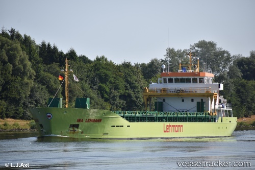
Vessel profile: Ina Lehmann is a Deck Cargo Ship with dimensions 90m x 15m.
This page combines live AIS, route history, probable destination signals, nearby traffic, and port activity for practical vessel monitoring.
The current position of vessel Ina Lehmann is 49.33225 lat / -4.11440 lng. Updated: 2026-05-20 17:35:02 UTCNearest reference points:
- Near Verzy
- 27 nm N of Verzy
- 12 nm S of Cornwall
Currently sailing under the flag of Antigua Barbuda ![]()
Details:
Live Vessel Ina Lehmann Analytics (details, animations, etc.)
Recent AIS points (UTC):
2026-05-20 13:35:52 UTC · 48.98563, -5.01502 · SOG 9 kn · COG 61°2026-05-20 16:04:02 UTC · 49.20213, -4.49113 · SOG 10.4 kn · COG 63°
2026-05-20 16:54:43 UTC · 49.27376, -4.28366 · SOG 11.1 kn · COG 63°
2026-05-20 17:35:02 UTC · 49.33225, -4.11440 · SOG 11.1 kn · COG 60°