 ULUSOY 16
Current Status
Where is the vessel?
ULUSOY 16 is currently in 32 nm W of Komiza, based on AIS data received about 14h ago.
Latest AIS update:
Current position: 42.85607° N, 15.39080° E (32 nm W of Komiza)
Average speed (last 7 days): Loading…
Average speed (last 30 days): Loading…
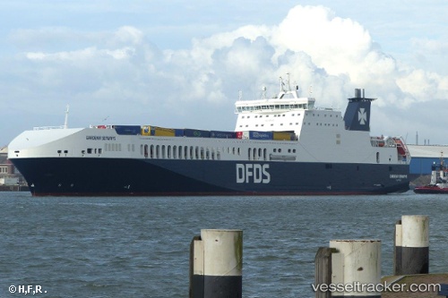
Vessel profile: ULUSOY 16 is a Ro-Ro Cargo Ship with dimensions 209m x 26m.
This page combines live AIS, route history, probable destination signals, nearby traffic, and port activity for practical vessel monitoring.
The current position of vessel ULUSOY 16 is 42.85607 lat / 15.39080 lng. Updated: 2026-05-31 10:26:30 UTCNearest reference points:
- 26 nm N of Isole Tremiti
- Near Primosten
- Near Podglavica
Currently sailing under the flag of Turkey ![]()
ULUSOY 16 built in 2017 year
Deadweight:
10310 tDetails:
Live Vessel ULUSOY 16 Analytics (details, animations, etc.)
Recent AIS points (UTC):
2026-05-31 07:19:41 UTC · 43.52032, 14.68477 · SOG 16 kn · COG 141°2026-05-31 07:38:36 UTC · 43.45237, 14.75382 · SOG 16.2 kn · COG 145°
2026-05-31 10:23:47 UTC · 42.86557, 15.38060 · SOG 16.1 kn · COG 141°
2026-05-31 10:26:30 UTC · 42.85607, 15.39080 · SOG 16.1 kn · COG 141°