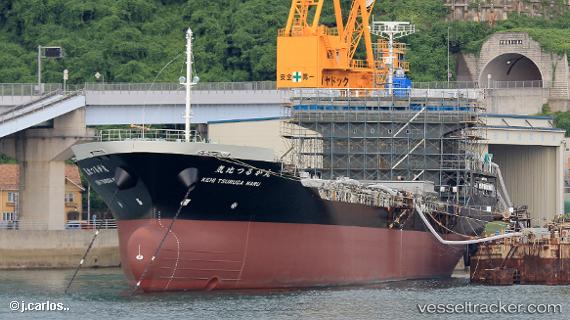
Kehi Tsuruga Maru
Current StatusWhere is the vessel?
Kehi Tsuruga Maru is currently in 16 nm NW of Ataka, based on AIS data received about 15h ago.
Latest AIS update:
Current position: 36.62810° N, 136.21323° E (16 nm NW of Ataka)
Average speed (last 7 days): Loading…
Average speed (last 30 days): Loading…
Vessel profile: Kehi Tsuruga Maru is a General Cargo Ship with dimensions 20m x 122m.
This page combines live AIS, route history, probable destination signals, nearby traffic, and port activity for practical vessel monitoring.
The current position of vessel Kehi Tsuruga Maru is 36.62810 lat / 136.21323 lng. Updated: 2026-05-18 17:54:46 UTCNearest reference points:
- Near Toyama
- Near Nagoya
- Near Yokkaichi
Details:
Live Vessel Kehi Tsuruga Maru Analytics (details, animations, etc.)
Recent AIS points (UTC):
2026-05-18 14:12:04 UTC · 35.99204, 135.84338 · SOG 11 kn · COG 23°2026-05-18 16:09:55 UTC · 36.33502, 136.02209 · SOG 11.4 kn · COG 28°
2026-05-18 17:11:15 UTC · 36.50465, 136.13889 · SOG 11.5 kn · COG 38°
2026-05-18 17:54:46 UTC · 36.62810, 136.21323 · SOG 11.4 kn · COG 24°