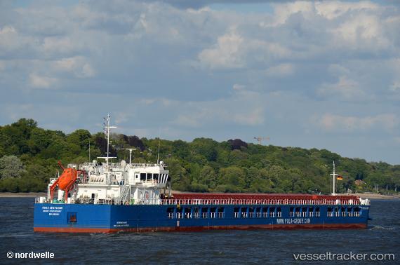
 Pola Anatolia
Current Status
Where is the vessel?
Pola Anatolia is currently in Near Samsun, based on AIS data received about 14h ago.
Latest AIS update:
Current position: 41.32906° N, 36.36803° E (Near Samsun)
Average speed (last 7 days): Loading…
Average speed (last 30 days): Loading…
Vessel profile: Pola Anatolia is a Multi Purpose Carrier with dimensions 140m x 16m.
This page combines live AIS, route history, probable destination signals, nearby traffic, and port activity for practical vessel monitoring.
The current position of vessel Pola Anatolia is 41.32906 lat / 36.36803 lng. Updated: 2026-05-18 20:02:54 UTCNearest reference points:
- Near Samsun
- 15 nm W of UNYE
- 22 nm E of Sinop
Currently sailing under the flag of Russia ![]()
Details:
Live Vessel Pola Anatolia Analytics (details, animations, etc.)
Recent AIS points (UTC):
2026-05-18 16:50:53 UTC · 41.32883, 36.36734 · SOG 0 kn · COG 7°2026-05-18 18:20:54 UTC · 41.32886, 36.36738 · SOG 0 kn · COG 359°
2026-05-18 19:26:54 UTC · 41.32891, 36.36762 · SOG 0 kn · COG 346°
2026-05-18 20:02:54 UTC · 41.32906, 36.36803 · SOG 0.1 kn · COG 312°