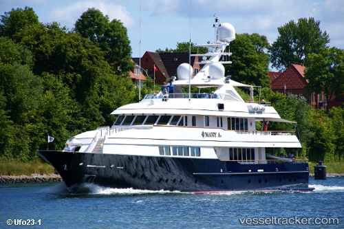
 Mary A
Current Status
Where is the vessel?
Mary A is currently in Near Buitenkaag, based on AIS data received about 14h ago.
Latest AIS update:
Current position: 52.21795° N, 4.55818° E (Near Buitenkaag)
Average speed (last 7 days): Loading…
Average speed (last 30 days): Loading…
Vessel profile: Mary A is a Service Ship with dimensions 42m x 8m.
This page combines live AIS, route history, probable destination signals, nearby traffic, and port activity for practical vessel monitoring.
The current position of vessel Mary A is 52.21795 lat / 4.55818 lng. Updated: 2026-06-26 03:26:57 UTCNearest reference points:
- Near Buitenkaag
- Near Teylingen
- Near Pijnacker-Nootdorp
Currently sailing under the flag of Cayman Is ![]()
Mary A built in 2001 year
Details:
Live Vessel Mary A Analytics (details, animations, etc.)
Recent AIS points (UTC):
2026-06-26 00:21:11 UTC · 52.21795, 4.55819 · SOG 0 kn · COG -1°2026-06-26 01:20:56 UTC · 52.21794, 4.55819 · SOG 0 kn · COG -1°
2026-06-26 02:17:58 UTC · 52.21796, 4.55818 · SOG 0 kn · COG -1°
2026-06-26 03:26:57 UTC · 52.21795, 4.55818 · SOG 0 kn · COG -1°