 vesseltracker.com
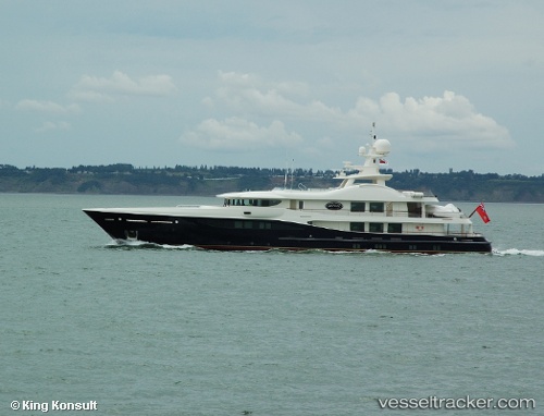
 Deniki
Current Status
Where is the vessel?
Deniki is currently in Near Monte-Carlo, based on AIS data received less than 1h ago.
Latest AIS update:
Current position: 43.72471° N, 7.41728° E (Near Monte-Carlo)
Average speed (last 7 days): Loading…
Average speed (last 30 days): Loading…
Vessel profile: Deniki is a Service Ship with dimensions 52m x 10m.
This page combines live AIS, route history, probable destination signals, nearby traffic, and port activity for practical vessel monitoring.
The current position of vessel Deniki is 43.72471 lat / 7.41728 lng. Updated: 2026-05-13 17:28:05 UTCNearest reference points:
- Near Monte-Carlo
- Near Monaco
- Near SAINTJEAN CAP FERRAT
Currently sailing under the flag of Malta ![]()
Deniki built in 2007 year
Details:
Live Vessel Deniki Analytics (details, animations, etc.)
Recent AIS points (UTC):
2026-05-13 14:21:44 UTC · 43.72035, 7.41422 · SOG 4.7 kn · COG 11°2026-05-13 15:33:56 UTC · 43.72469, 7.41728 · SOG 0 kn · COG 222°
2026-05-13 16:33:56 UTC · 43.72472, 7.41729 · SOG 0 kn · COG 222°
2026-05-13 17:28:05 UTC · 43.72471, 7.41728 · SOG 0 kn · COG 222°