 vesseltracker.com
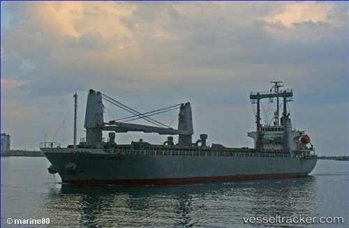
 ADNAN N
Current Status
Where is the vessel?
ADNAN N is currently in Near Isdemir, based on AIS data received less than 1h ago.
Latest AIS update:
Current position: 36.69610° N, 36.19237° E (Near Isdemir)
Average speed (last 7 days): Loading…
Average speed (last 30 days): Loading…
Vessel profile: ADNAN N is a General Cargo Ship with dimensions 20m x 116m.
This page combines live AIS, route history, probable destination signals, nearby traffic, and port activity for practical vessel monitoring.
The current position of vessel ADNAN N is 36.69610 lat / 36.19237 lng. Updated: 2026-04-22 07:05:39 UTCNearest reference points:
- Near Iskenderun
- Near DORTYOL
- Near CEYHAN
Currently sailing under the flag of Barbados ![]()
ADNAN N built in 2006 year
Deadweight:
11776 tDetails:
Live Vessel ADNAN N Analytics (details, animations, etc.)
Recent AIS points (UTC):
2026-04-22 04:11:42 UTC · 36.69611, 36.19240 · SOG 0 kn · COG 242°2026-04-22 04:38:42 UTC · 36.69609, 36.19240 · SOG 0 kn · COG 242°
2026-04-22 05:59:01 UTC · 36.69609, 36.19239 · SOG 0 kn · COG 242°
2026-04-22 07:05:39 UTC · 36.69610, 36.19237 · SOG 0 kn · COG 242°