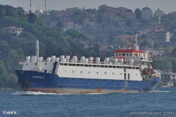
 Barhom Ii
Current Status
Where is the vessel?
Barhom Ii is currently in 62 nm E of Ryuo, based on AIS data received about 22h ago.
Latest AIS update:
Current position: 36.04167° N, 17.80333° E (62 nm E of Ryuo)
Average speed (last 7 days): Loading…
Average speed (last 30 days): Loading…
Vessel profile: Barhom Ii is a Livestock Carrier with dimensions 83m x 19m.
This page combines live AIS, route history, probable destination signals, nearby traffic, and port activity for practical vessel monitoring.
The current position of vessel Barhom Ii is 36.04167 lat / 17.80333 lng. Updated: 2026-05-20 00:53:16 UTCNearest reference points:
- 64 nm NE of Ryuo
- 53 nm NE of Ryuo
- 103 nm NE of Ryuo
Currently sailing under the flag of Tanzania ![]()
Barhom Ii built in 1977 year
Deadweight:
2992 tDetails:
Live Vessel Barhom Ii Analytics (details, animations, etc.)
Recent AIS points (UTC):
2026-05-20 00:53:16 UTC · 36.04167, 17.80333 · SOG 8 kn · COG -1°2026-05-20 00:53:16 UTC · 36.04167, 17.80333 · SOG 8 kn · COG -1°
2026-05-20 00:53:16 UTC · 36.04167, 17.80333 · SOG 8 kn · COG -1°
2026-05-20 00:53:16 UTC · 36.04167, 17.80333 · SOG 8 kn · COG -1°