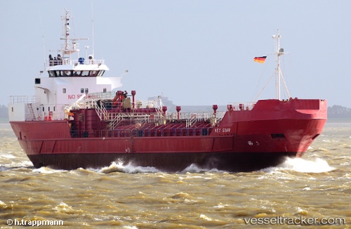
 NOR STAR
Current Status
Where is the vessel?
NOR STAR is currently in Near Rekefjord, based on AIS data received about 14h ago.
Latest AIS update:
Current position: 58.26615° N, 6.02681° E (Near Rekefjord)
Average speed (last 7 days): Loading…
Average speed (last 30 days): Loading…
Vessel profile: NOR STAR is a Chemical Tanker with dimensions m x m.
This page combines live AIS, route history, probable destination signals, nearby traffic, and port activity for practical vessel monitoring.
The current position of vessel NOR STAR is 58.26615 lat / 6.02681 lng. Updated: 2026-05-21 01:46:04 UTCNearest reference points:
- Near Egersund
- Near Åna-Sira
- Near Kirkehamn
Currently sailing under the flag of Guinea ![]()
Details:
Live Vessel NOR STAR Analytics (details, animations, etc.)
Recent AIS points (UTC):
2026-05-20 23:06:24 UTC · 57.94882, 6.74546 · SOG 11.3 kn · COG 290°2026-05-20 23:26:24 UTC · 57.97047, 6.63286 · SOG 11.3 kn · COG 287°
2026-05-21 01:26:34 UTC · 58.22548, 6.10766 · SOG 10.9 kn · COG 313°
2026-05-21 01:46:04 UTC · 58.26615, 6.02681 · SOG 11.1 kn · COG 313°