 Tangaroa
Current Status
Where is the vessel?
Tangaroa is currently in 13 nm N of Napieir, based on AIS data received about 14h ago.
Latest AIS update:
Current position: 39.26535° S, 177.03680° E (13 nm N of Napieir)
Average speed (last 7 days): Loading…
Average speed (last 30 days): Loading…
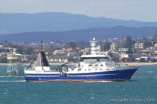
Vessel profile: Tangaroa is a Fishing Support Vessel with dimensions 70m x 14m.
This page combines live AIS, route history, probable destination signals, nearby traffic, and port activity for practical vessel monitoring.
The current position of vessel Tangaroa is -39.26535 lat / 177.03680 lng. Updated: 2026-05-23 02:47:14 UTCNearest reference points:
- Near WHITIANGA
- Near ORAKEI
- Near WESTHAVEN
Currently sailing under the flag of New Zealand ![]()
Tangaroa built in 1991 year
Details:
Live Vessel Tangaroa Analytics (details, animations, etc.)
Recent AIS points (UTC):
2026-05-22 22:26:46 UTC · -39.27213, 177.10487 · SOG 10.7 kn · COG 222°2026-05-22 23:30:57 UTC · -39.38938, 176.97417 · SOG 7.4 kn · COG 188°
2026-05-23 01:47:45 UTC · -39.32337, 176.99519 · SOG 7.4 kn · COG 20°
2026-05-23 02:47:14 UTC · -39.26535, 177.03680 · SOG 1.3 kn · COG 70°