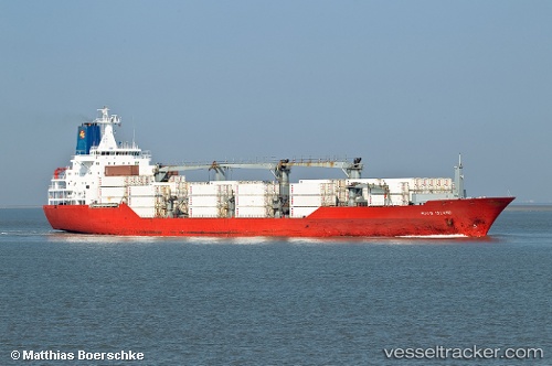
 Hood Island
Current Status
Where is the vessel?
Hood Island is currently in 276 nm S of Benahavis, based on AIS data received about 14h ago.
Latest AIS update:
Current position: 32.21040° N, 52.44145° W (276 nm S of Benahavis)
Average speed (last 7 days): Loading…
Average speed (last 30 days): Loading…
Vessel profile: Hood Island is a Refrigerated Cargo Ship with dimensions 179m x 179m.
This page combines live AIS, route history, probable destination signals, nearby traffic, and port activity for practical vessel monitoring.
The current position of vessel Hood Island is 32.21040 lat / -52.44145 lng. Updated: 2026-05-25 16:22:36 UTCNearest reference points:
- 244 nm SW of Benahavis
- Open sea, approx. 402 nm off the nearest listed port
- Open sea, approx. 401 nm off the nearest listed port
Currently sailing under the flag of Bahamas ![]()
Hood Island built in 1994 year
Deadweight:
14140 tDetails:
Live Vessel Hood Island Analytics (details, animations, etc.)
Recent AIS points (UTC):
2026-05-25 13:38:09 UTC · 31.74032, -53.07572 · SOG 18 kn · COG 50°2026-05-25 14:00:11 UTC · 31.80929, -52.97879 · SOG 15.6 kn · COG 50°
2026-05-25 15:43:48 UTC · 32.10356, -52.58704 · SOG 15.3 kn · COG 49°
2026-05-25 16:22:36 UTC · 32.21040, -52.44145 · SOG 15 kn · COG 48°