 vesseltracker.com
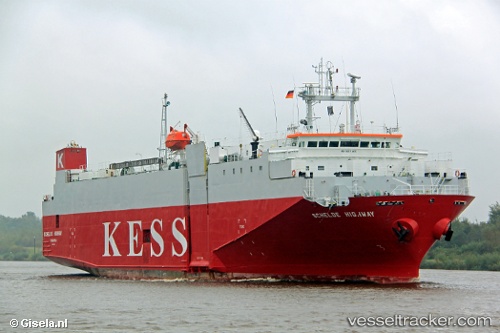
 Schelde Highway
Current Status
Where is the vessel?
Schelde Highway is currently in Near Dover, based on AIS data received less than 1h ago.
Latest AIS update:
Current position: 51.01222° N, 1.34620° E (Near Dover)
Average speed (last 7 days): Loading…
Average speed (last 30 days): Loading…
Vessel profile: Schelde Highway is a Vehicles Carrier with dimensions 100m x 21m.
This page combines live AIS, route history, probable destination signals, nearby traffic, and port activity for practical vessel monitoring.
The current position of vessel Schelde Highway is 51.01222 lat / 1.34620 lng. Updated: 2026-05-16 12:23:17 UTCNearest reference points:
- Near Dover
- Near Folkestone
- Near Le Portel
Currently sailing under the flag of Panama ![]()
Schelde Highway built in 1993 year
Deadweight:
3222 tDetails:
Live Vessel Schelde Highway Analytics (details, animations, etc.)
Recent AIS points (UTC):
2026-05-16 07:43:09 UTC · 51.37754, 2.62828 · SOG 13.6 kn · COG 289°2026-05-16 09:35:17 UTC · 51.39274, 1.96202 · SOG 14.3 kn · COG 223°
2026-05-16 10:03:08 UTC · 51.31262, 1.85215 · SOG 13.2 kn · COG 217°
2026-05-16 12:23:17 UTC · 51.01222, 1.34620 · SOG 10.2 kn · COG 230°