 vesseltracker.com
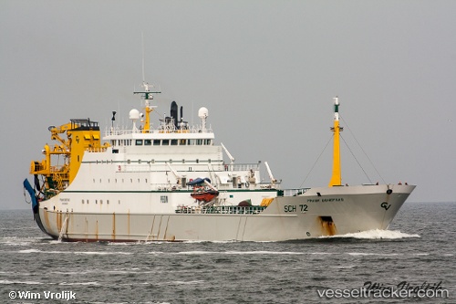
 FRANK BONEFAAS
Current Status
Where is the vessel?
FRANK BONEFAAS is currently in Near Hunsdon, based on AIS data received about 14h ago.
Latest AIS update:
Current position: 51.74361° N, 3.28322° E (Near Hunsdon)
Average speed (last 7 days): Loading…
Average speed (last 30 days): Loading…
Vessel profile: FRANK BONEFAAS is a Fishing Vessel with dimensions 119m x 17m.
This page combines live AIS, route history, probable destination signals, nearby traffic, and port activity for practical vessel monitoring.
The current position of vessel FRANK BONEFAAS is 51.74361 lat / 3.28322 lng. Updated: 2026-05-18 07:51:12 UTCNearest reference points:
- Near Hunsdon
- 12 nm NE of Hunsdon
- Near Thorntonbank
Currently sailing under the flag of United Kingdom ![]()
FRANK BONEFAAS built in 1994 year
Deadweight:
6011 tDetails:
Live Vessel FRANK BONEFAAS Analytics (details, animations, etc.)
Recent AIS points (UTC):
2026-05-18 04:49:01 UTC · 52.11711, 3.36904 · SOG 12.6 kn · COG 201°2026-05-18 05:33:02 UTC · 51.96952, 3.30709 · SOG 12.6 kn · COG 189°
2026-05-18 07:38:51 UTC · 51.77463, 3.27082 · SOG 9.3 kn · COG 160°
2026-05-18 07:51:12 UTC · 51.74361, 3.28322 · SOG 8.9 kn · COG 161°