 CAN YUCEL
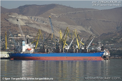
Current Status
Where is the vessel?
CAN YUCEL is currently in Near NEMRUT, based on AIS data received about 16h ago.
Latest AIS update:
Current position: 38.76525° N, 26.93204° E (Near NEMRUT)
Average speed (last 7 days): Loading…
Average speed (last 30 days): Loading…
Vessel profile: CAN YUCEL is a Bulk Carrier with dimensions 180m x 31m.
This page combines live AIS, route history, probable destination signals, nearby traffic, and port activity for practical vessel monitoring.
The current position of vessel CAN YUCEL is 38.76525 lat / 26.93204 lng. Updated: 2026-05-20 19:29:40 UTCNearest reference points:
- Near NEMRUT
- Near Nemrut Bay
- Near Aliaga
Currently sailing under the flag of Liberia ![]()
CAN YUCEL built in 1995 year
Deadweight:
38852 tDetails:
Live Vessel CAN YUCEL Analytics (details, animations, etc.)
Recent AIS points (UTC):
2026-05-20 15:53:43 UTC · 38.76524, 26.93203 · SOG 0 kn · COG 90°2026-05-20 16:11:40 UTC · 38.76525, 26.93201 · SOG 0 kn · COG 90°
2026-05-20 18:02:42 UTC · 38.76526, 26.93203 · SOG 0 kn · COG 90°
2026-05-20 19:29:40 UTC · 38.76525, 26.93204 · SOG 0 kn · COG 90°